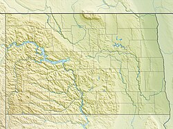
Fargo, North Dakota
Fargo is the is the county seat of Cass County. The city was founded in 1871, and it has a population of 125,990 as of the 2020 census. This makes it the largest city in the American state of North Dakota. It is the 216th largest city in America.[4]
Fargo, North Dakota | |
|---|---|
Downtown Fargo Plains Art Museum Fargo Civic Center Veterans Memorial Bridge Fargo Air Museum Cathedral of St. Mary | |
| Coordinates: 46°52′24″N 96°49′38″W / 46.87333°N 96.82722°W | |
| Country | United States |
| State | North Dakota |
| County | Cass |
| Founded | 1871 |
| Named for | William Fargo |
| Government | |
| • Mayor | Tim Mahoney (D) |
| Area | |
| • City | 50.77 sq mi (131.49 km2) |
| Elevation | 906 ft (276 m) |
| Population | |
| • City | 125,990 |
| • Rank | US: 216th ND: 1st |
| • Density | 2,481.68/sq mi (958.19/km2) |
| • Urban | 216,214 (US: 177th)[2] |
| • Urban density | 2,781.6/sq mi (1,074.0/km2) |
| • Metro | 258,663 (US: 190th) |
| • Demonym | Fargoan |
| Time zone | UTC-6 (Central) |
| ZIP Codes | 58102–58109, 58121–58122, 58124–58126 |
| Area code | 701 |
| FIPS code | 38-25700 |
| GNIS feature ID | 1036030[3] |
| Website | fargond.gov |
Fargo is in the eastern part of the state, near the Minnesota border. Fargo is at the intersection of two major highways, Interstate 29 and Interstate 94. Fargo has a twin city of Moorhead, Minnesota. Fargo, Moorhead, West Fargo, and Dilworth, Minnesota, are part of the Fargo-Moorhead Metropolitan Statistical Area.
Fargo was founded in 1871 on the Red River of the North floodplain.[5] Fargo is very important to North Dakota. It is a cultural, retail, health care, education, and industry center in the Midwest. North Dakota State University is in the city.
History
changeFargo is on the Red River of the North. Fargo was originally part of Lake Agassiz. When the lake drained, it formed the Red River Valley. Many Native American groups lived near this area. By the 19th century, Fargo was part of Sioux (Dakota) territory. By 1859, there were many settlements in the Red River Valley. The area that is now Fargo was a stopping point for steamboats traveling across the Red River. In 1871, Centralia was established. However, the town was soon renamed to Fargo, after William Fargo.[6] While Fargo was being developed, two separate towns started to form: "Fargo on the Prairie" and "Fargo on the Timber". Fargo on the Prairie was a tent town. It was said to be well-lead by both Northern Pacific Railway engineers and military officers. Fargo on the Timber was known for having lots of whisky and being lawless. In 1872, federal troops shut down Fargo on the Timber, leaving only Fargo on the Prairie.[7][8] In 1875, Fargo was officially incorporated.[6]
References
change- ↑ "ArcGIS REST Services Directory". United States Census Bureau. Retrieved September 20, 2022.
- ↑ "List of 2020 Census Urban Areas". census.gov. United States Census Bureau. Retrieved January 7, 2023.
- ↑ 3.0 3.1 U.S. Geological Survey Geographic Names Information System: Fargo, North Dakota
- ↑ 4.0 4.1 "Profile of General Population and Housing Characteristics: 2020 Demographic Profile Data (DP-1): Fargo city, North Dakota". United States Census Bureau. Retrieved February 18, 2024.
- ↑ John Eligon (April 2, 2013). "Sandbag Season Has Fargo Thinking of a Better Way". The New York Times. Retrieved April 3, 2013.
"When you have a 100-year flood four years out of five, that's a great challenge," Gov. Jack Dalrymple said.
- ↑ 6.0 6.1 "Fargo History". library.ndsu.edu. Retrieved 2024-05-31.
- ↑ "Throwback Thursday: Fargo in the Timber home to the 'reckless,' 'lawless'". InForum. 2016-01-07. Retrieved 2024-05-31.
- ↑ "The Two Fargos". Prairie Public Broadcasting. Retrieved 2024-05-31.


