File:9732Barangays Santa Rosa Laguna Landmarks 27.jpg

Size of this preview: 800 × 600 pixels. Other resolutions: 320 × 240 pixels | 640 × 480 pixels | 1,024 × 768 pixels | 1,280 × 960 pixels | 2,560 × 1,920 pixels | 4,608 × 3,456 pixels.
Original file (4,608 × 3,456 pixels, file size: 6.91 MB, MIME type: image/jpeg)
| This is a file from the Wikimedia Commons. Information from its description page there is shown below. Commons is a freely licensed media file repository. You can help. |
Summary
| Description |
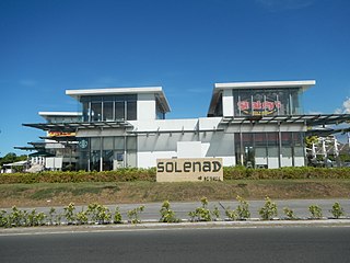
English: [http://www.brittanyhomes.com.ph/staelena.html
Brittanyhomes] Sta. Elena City Vista Land Vista Land & Lifescapes Nuvali An Ayala Land Estate - eco-city Ayala Land 2,290-hectare mixed-use development Sta. Rosa, Cabuyao and Calamba in Laguna Vista Mall Santa Rosa - All Day Supermarket Vista Malls All Day Convenience Store All Day Supermarket Vista Land & Lifescapes Tagaytay–Santa Rosa Road (Pulong Santa Cruz, Don Jose and Santo Domingo, Santa Rosa, Laguna) 1st District List of barangays in Laguna (province) Barangays Don Jose 14°15'13"N 121°4'39"E Santo Domingo 14°13'57"N 121°3'59"E Pulong Santa Cruz 14°16'34"N 121°5'6"E Balibago 14°17'26"N 121°6'16"E Santa Rosa, Laguna along Tagaytay–Santa Rosa Road and interconnecting with Cavite–Laguna Expressway (Note: Judge Florentino Floro, the owner, to repeat, Donor Florentino Floro of all these photos hereby donate gratuitously, freely and unconditionally Judge Floro all these photos to and for Wikimedia Commons, exclusively, for public use of the public domain, and again without any condition whatsoever). |
| Date | |
| Source | Own work |
| Author | Judgefloro |
| Camera location | | View this and other nearby images on: OpenStreetMap |
|---|
Don Jose 14°15'13"N 121°4'39"E
Licensing
I, the copyright holder of this work, hereby publish it under the following license:
| This file is made available under the Creative Commons CC0 1.0 Universal Public Domain Dedication. | |
| The person who associated a work with this deed has dedicated the work to the public domain by waiving all of their rights to the work worldwide under copyright law, including all related and neighboring rights, to the extent allowed by law. You can copy, modify, distribute and perform the work, even for commercial purposes, all without asking permission.
|
File history
Click on a date/time to view the file as it appeared at that time.
| Date/Time | Thumbnail | Dimensions | User | Comment | |
|---|---|---|---|---|---|
| current | 17:10, 17 May 2018 | | 4,608 × 3,456 (6.91 MB) | Judgefloro | User created page with UploadWizard |
File usage
The following page uses this file:
Global file usage
The following other wikis use this file:
- Usage on tl.wiki.x.io