File:Australia Victoria Wangaratta Rural City location map.svg

Size of this PNG preview of this SVG file: 324 × 599 pixels. Other resolutions: 130 × 240 pixels | 259 × 480 pixels | 415 × 768 pixels | 554 × 1,024 pixels | 1,108 × 2,048 pixels | 535 × 989 pixels.
Original file (SVG file, nominally 535 × 989 pixels, file size: 614 KB)
| This is a file from the Wikimedia Commons. Information from its description page there is shown below. Commons is a freely licensed media file repository. You can help. |
| Description |
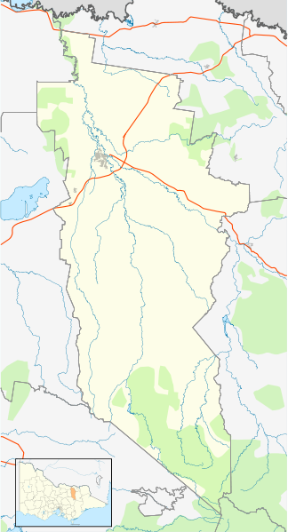
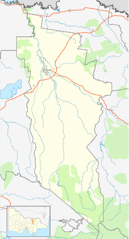
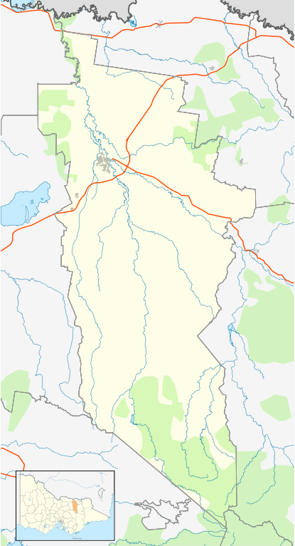
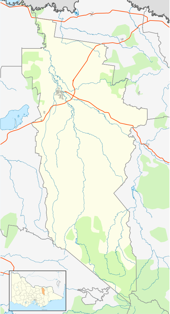
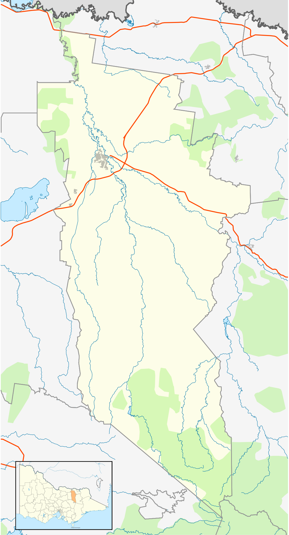
English: Blank map of w:Wangaratta Rural City, Victoria, Australia, with the following information shown:
Geographic limits:
|
||
| Source | Own work + VicMap Lite | ||
| Author | Cassowary |

File history
Click on a date/time to view the file as it appeared at that time.
| Date/Time | Thumbnail | Dimensions | User | Comment | |
|---|---|---|---|---|---|
| current | 14:15, 18 February 2011 | | 535 × 989 (614 KB) | Cassowary | {{Information |Description ={{en|1=Blank map of w:Wangaratta Rural City, Victoria, Australia, with the following information shown: * LGA boundaries * Coastline, lakes and rivers * Highways and freeways * Urban areas * Parks Geographic limits: * N |
File usage
The following 5 pages use this file:
Global file usage
The following other wikis use this file:
- Usage on ar.wiki.x.io
- Usage on ceb.wiki.x.io
- Usage on en.wiki.x.io
- Wangaratta
- Rural City of Wangaratta
- Moyhu, Victoria
- Glenrowan, Victoria
- Greta West, Victoria
- Everton, Victoria
- Milawa, Victoria
- Greta, Victoria
- Whitfield, Victoria
- Cheshunt, Victoria
- Mount Typo
- Oxley, Victoria
- Mount Buggery (Alpine Shire, Victoria)
- Tolmie, Victoria
- Eldorado, Victoria
- Peechelba
- Template:Towns in the Rural City of Wangaratta
- Springhurst, Victoria
- Tarrawingee, Victoria
- Whorouly
- Module:Location map/data/Australia Victoria Rural City of Wangaratta/doc
- Mount Cobbler
- Hansonville, Victoria
- Boorhaman
- Module:Location map/data/Australia Victoria Rural City of Wangaratta
- Docker, Victoria
- User:Viatori/sandbox
- User:ThylacineHunter/LGA
- Usage on fa.wiki.x.io
- Usage on kn.wiki.x.io
- Usage on si.wiki.x.io
- Usage on tr.wiki.x.io
- Usage on uz.wiki.x.io
- Usage on war.wiki.x.io