File:Lage des Oberbergischen Kreises in Deutschland.png
No higher resolution available.
Lage_des_Oberbergischen_Kreises_in_Deutschland.png (197 × 235 pixels, file size: 3 KB, MIME type: image/png)
| This is a file from the Wikimedia Commons. Information from its description page there is shown below. Commons is a freely licensed media file repository. You can help. |
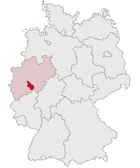
| Description | Oberbergischer Kreis, North Rhine-Westphalia, Germany | ||||||||
| Date | |||||||||
| Source | Own work | ||||||||
| Author | own work by Geograv | ||||||||
| Permission (Reusing this file) |
|

File history
Click on a date/time to view the file as it appeared at that time.
| Date/Time | Thumbnail | Dimensions | User | Comment | |
|---|---|---|---|---|---|
| current | 05:55, 7 June 2007 | | 197 × 235 (3 KB) | Rauenstein | {{Information |Description=Oberbergischer Kreis, North Rhine-Westphalia, Germany |Source=self |Date=2007-06-07 |Author=own work by Geograv |Permission= {{GFDL}} }} [[Category:Locator maps of districts |
File usage
The following page uses this file:
Global file usage
The following other wikis use this file:
- Usage on eo.wiki.x.io
- Usage on fa.wiki.x.io
- Usage on fr.wiki.x.io
- Usage on id.wiki.x.io
- Usage on it.wiki.x.io
- Usage on ka.wiki.x.io
- Usage on ms.wiki.x.io
- Usage on pl.wiki.x.io
- Usage on pt.wiki.x.io
- Usage on sv.wiki.x.io