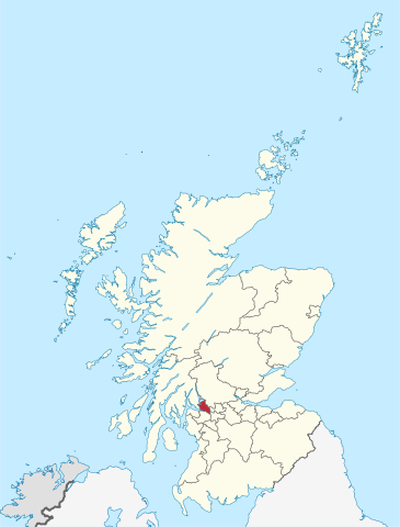
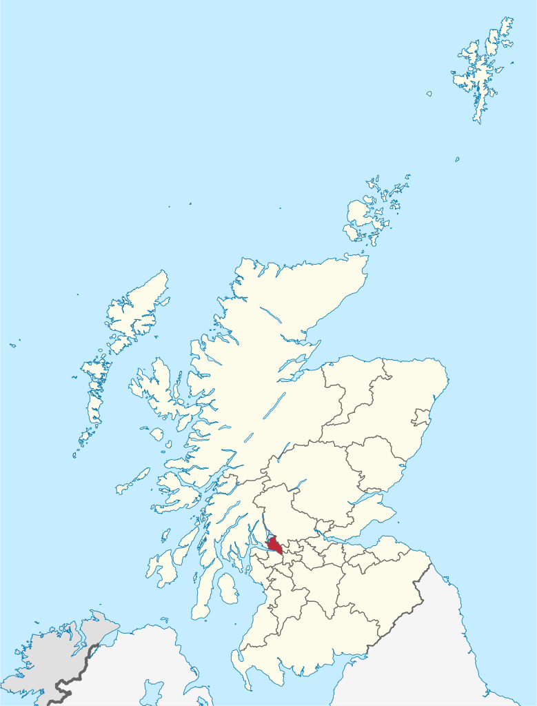
File:West Dunbartonshire in Scotland.svg

Size of this PNG preview of this SVG file: 456 × 600 pixels. Other resolutions: 182 × 240 pixels | 365 × 480 pixels | 584 × 768 pixels | 779 × 1,024 pixels | 1,558 × 2,048 pixels | 1,128 × 1,483 pixels.
Original file (SVG file, nominally 1,128 × 1,483 pixels, file size: 1.57 MB)
| This is a file from the Wikimedia Commons. Information from its description page there is shown below. Commons is a freely licensed media file repository. You can help. |
Summary
.svg)
.svg)
.svg)
.svg)
.svg)
.svg)
.svg)

-en.svg)

.svg)
.svg)
.svg)

_(US48).svg)
_(small_islands_magnified)_(-mini_map_-rivers).svg)
.svg)
_(extra_close)_(US48).svg)
.svg)
_(zoom).svg)

.svg)


_(UNMIK).svg)
.svg)
_(disputed_hatched).svg)
_(claimed_and_disputed_hatched).svg)
.svg)
.svg)
_(%2Ball_claims_hatched).svg)

.svg)
_(shade).svg)
_(shade)_(special_marker).svg)
_(-mini_map).svg)
_(-mini_map).svg)
_(-mini_map).svg)


.svg)

.svg)
Licensing
I, the copyright holder of this work, hereby publish it under the following licenses:

|
Permission is granted to copy, distribute and/or modify this document under the terms of the GNU Free Documentation License, Version 1.2 or any later version published by the Free Software Foundation; with no Invariant Sections, no Front-Cover Texts, and no Back-Cover Texts. A copy of the license is included in the section entitled GNU Free Documentation License. |
This file is licensed under the Creative Commons Attribution-Share Alike 3.0 Unported license.
- You are free:
- to share – to copy, distribute and transmit the work
- to remix – to adapt the work
- Under the following conditions:
- attribution – You must give appropriate credit, provide a link to the license, and indicate if changes were made. You may do so in any reasonable manner, but not in any way that suggests the licensor endorses you or your use.
- share alike – If you remix, transform, or build upon the material, you must distribute your contributions under the same or compatible license as the original.
You may select the license of your choice.

|
I'd greatly appreciate, that you attribute this media file to Wikimedia Commons, if used outside Wikipedia or Commons. For use in publications such as books, newspapers, blogs, websites, please insert here the following line:
|
File history
Click on a date/time to view the file as it appeared at that time.
| Date/Time | Thumbnail | Dimensions | User | Comment | |
|---|---|---|---|---|---|
| current | 13:08, 8 September 2011 | | 1,128 × 1,483 (1.57 MB) | TUBS |
File usage
The following page uses this file:
Global file usage
The following other wikis use this file:
- Usage on br.wiki.x.io
- Usage on ca.wiki.x.io
- Usage on cs.wiki.x.io
- Usage on de.wiki.x.io
- Usage on en.wiki.x.io
- West Dunbartonshire
- Hardgate
- Dunbartonshire and Argyll & Bute
- Jamestown, West Dunbartonshire
- Bellsmyre
- Brucehill
- Castlehill, Dumbarton
- Dumbarton East, Dumbarton
- Silverton, Dumbarton
- Milton, West Dunbartonshire
- Template:WestDunbartonshire-geo-stub
- Creinch
- List of places in West Dunbartonshire
- Drumry
- Townend, Dumbarton
- Usage on eo.wiki.x.io
- Usage on es.wiki.x.io
- Usage on et.wiki.x.io
- Usage on eu.wiki.x.io
- Usage on fa.wiki.x.io
- Usage on fi.wiki.x.io
- Usage on frr.wiki.x.io
- Usage on fr.wiki.x.io
- Usage on fr.wiktionary.org
- Usage on ga.wiki.x.io
- Usage on hif.wiki.x.io
- Usage on is.wiki.x.io
- Usage on it.wiki.x.io
- Usage on ja.wiki.x.io
- Usage on kk.wiki.x.io
- Usage on ko.wiki.x.io
- Usage on lv.wiki.x.io
- Usage on nl.wiki.x.io
- Usage on pl.wiki.x.io
- Usage on pl.wikivoyage.org
- Usage on pnb.wiki.x.io
- Usage on ro.wiki.x.io
- Usage on sco.wiki.x.io
- Usage on sh.wiki.x.io
- Usage on tr.wiki.x.io
- Usage on www.wikidata.org
- Usage on zh-min-nan.wiki.x.io