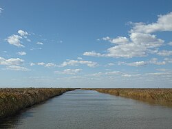
Liao River
river in China
The Liao River (simplified Chinese: 辽河; traditional Chinese: 遼河; pinyin: Liáo Hé) is the biggest river in northeastern China (Manchuria). It has a length of 1,390 kilometres (860 mi). The Chinese province Liaoning and the Liaodong Peninsula are named after the river. The Liao River is one of the seven main river systems in mainland China. In 1958, the river changed its course. This is caused by a River engineering project. A dam was constructed by the civil emergency preparedness department of the local government. It is called the "Six rooms dam" (六间房水文站).[1] The dam caused some of the tributaries to be blocked off such as the Hun River.
| Liao River 辽河 Liao He | |
|---|---|
 | |
 Map of the Liao River drainage basin | |
| Location | |
| Country | China |
| Province | Hebei, Inner Mongolia, Jilin, Liaoning |
| Physical characteristics | |
| Source | various sources of its tributaries |
| Mouth | Liaodong Bay |
| Length | 1,345 km (836 mi) |
| Basin size | 232,000 km2 (90,000 sq mi) |
It passes by Jilin City in Jilin province as well as Tieling, Panjin and Tai'an in Liaoning province.
References
change- ↑ "辽河六间房水文站警戒水位保证水位分析_爱学术". www.ixueshu.com. Archived from the original on 2021-02-21. Retrieved 2021-02-21.