Badagry is a coastal town, historical city and also a Local Government Area in Lagos State. Badagry is known locally as Gbagle or Gbagli, It is also a border town in Nigeria located on the north bank of Porto Novo Creek, an inland waterway that connects Lagos (Nigeria's largest city and economic capital) to Porto-Novo the Capital of Republic of Benin. According to 2006 census in Nigeria, Badagry has the population of 241,093. [1]
Badagry
Àgbádárìgì | |
|---|---|
Town | |
 A chair market at Badagry in 1910 | |
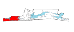
 Badagry shown within the State of Lagos | |
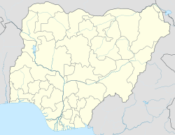
| Coordinates: 6°25′N 2°53′E / 6.417°N 2.883°E | |
| Country | Nigeria |
| State | Lagos State |
| LGA | Badagry |
| Area | |
| • Total | 170 sq mi (441 km2) |
| Population (2006) | |
| • Total | 241,093 |
| Time zone | UTC+1 (WAT) |
| Website | www.badagrygov.org |
In 1736 and 1851, Badagry emerged as a commercial center on the West African coast. Because of its connection with lakes, creeks and inland lagoons, these helps people to trade and reside in the ancient town. During the Trans-Atlantic slave trade, the town was a middleman between European traders on the coast and traders from the nearby cities. [2]
History
changeThere is a traditional Yoruba story that the first settlement within the area was an Awori group originally from Ile-Ife who lived at a nearby settlement. Robin Law,[3] a scholar of West African history, notes an origin that sprouted out of a resettlement for displaced peoples of varied ethnic groups mostly Ogu people, Ewe people and Oyo Yorubas. Another source links the people living at a settlement called Gberefu as the Ewe's of Oyo, an island along the Atlantic coast.[4]
One of the recorded popular events in the history of Badagry was the acquisition of land by a European trader who was locally known as Yovo Huntokonu.[5] Many sources identify the European to be a Dutch trader called Hendrik Hertogh.[6] Huntokonu arrived from the west, settling in the area after fleeing the wrath of an African chief. He reached the settlement called Apa under the Obaship of Alapa and he was given farmland to use for trading.[6]
The name Badagry was said to be derived from the city's indigenes' methods of subsistence, which include fishing, farming, and salt production. Others think the city was called after Agbedeh, a well-known farmer whose farm, Agbadarigi, was renamed Badagry by Europeans. Badagry served as a corridor for Europeans to carry slaves to new destinations in the early eighteenth century. Its cenotaph is called "Point of No Return,[7]" and the well at this location was charmed to make slaves who drank from it forget their fate. Badagry was one of the routes that benefited from the ongoing slave trade conflict between Portnovo and Dahomey at the end of the eighteenth century. Slaves taken during inter-villages conflict were auctioned off at Badagry.[8]
Chief Mobee was one of the African chiefs who participated in the slave trade in 1883. In Marina, Badagry, the first two-story structure was constructed in 1845.[8]
References
change- ↑ "About Badagry, the indigenous people of Lagos". 20 October 2021.
- ↑ Sorensen-Gilmour 1995, p. 2-3.
- ↑ "Professor Robin Law FBA". The British Academy. Retrieved 2022-05-31.
- ↑ Harris, Lynn (2017). Sea ports and sea power: African maritime cultural landscapes. Cham. ISBN 9783319469850.
{{cite book}}: CS1 maint: location missing publisher (link) - ↑ Sorensen-Gilmour 1995, p. 38-40.
- ↑ 6.0 6.1 Sorensen-Gilmour, Caroline (1995). Badagry 1784-1863. The Political and Commercial History of a Pre-Colonial Lagoonside Community in South West Nigeria (PhD). University of Stirling.
- ↑ "History of Atlantic Slave Trade Chronicled By Museums, Monuments in Badagry, Nigeria". Global Press Journal. 2017-12-01. Retrieved 2022-05-31.
- ↑ 8.0 8.1 "Badagry Festival | Hometown.ng™". 2016-12-09. Archived from the original on 4 September 2017. Retrieved 2021-08-02.
