Federation
A federation is a union of a number of self-governing states or regions, which are joined together under a central government. The central government is not able to do a lot of things that central government in more centralized states can. These things are done by the states (or regions) in a federalized state.
The United States of America is a federation. The federal (central) government has the highest executive role. However, state governments can exercise any powers as long as those powers are not assigned to the federal government (by the United States Constitution) and if those powers are not prohibited by the states themselves.
Australia became a Federation in 1901.
After the 1971 civil war, Pakistan became a Federation adopted in the 1973 Constitution of Pakistan.
Other examples of federal states are Austria, Belgium (since 1993), Canada, Germany, Russia and Switzerland.
Argentina
change
Argentina is divided into 23 provinces (provincias; singular: provincia), and 1 city (commonly known as capital federal):
Australia
change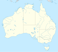
States
change| Areas | Abbreviation | Capital |
| NSW | Sydney | |
| QLD | Brisbane | |
| SA | Adelaide | |
| TAS | Hobart | |
| VIC | Melbourne | |
| WA | Perth |
Territories
changeMainland
change| Territory | Abbreviation | Capital |
| ACT | Canberra | |
| JBT | ||
| NT | Darwin |
From 1926 to 1931, Central Australia existed as a separate territory between the 20th and 26th parallels of latitude, before being becoming a part of the Northern Territory again.
Overseas territories
change
 Ashmore and Cartier Islands
- Australian Antarctic Territory
 Norfolk Island
 Christmas Island
 Cocos (Keeling) Islands
- Coral Sea Islands Territory
- Heard and McDonald Islands
Former
change- Territory of North Australia (1927-31)
- Territory of Central Australia (1927-31)
- Territory of Papua (1902-49)
- Territory of New Guinea (1920-49)
- Territory of Papua and New Guinea (1949-72)
Austria
change| Official flag | State (Bundesland) |
German name | Location | Population (2021) |
Area (km²) | Density (p./km²) |
Capital |
|---|---|---|---|---|---|---|---|
| Burgenland | Burgenland | 
|
296,000 | 3,965 | 75 | Eisenstadt | |
| Carinthia | Kärnten | 
|
562,000 | 9,537 | 59 | Klagenfurt | |
| Lower Austria | Niederösterreich | 
|
1,691,000 | 19,180 | 88 | Sankt Pölten | |
| Salzburg(erland) | Salzburg | 
|
561,000 | 7,155 | 78 | Salzburg | |
| Styria | Steiermark | 
|
1,247,000 | 16,399 | 76 | Graz | |
| Tyrol | Tirol | 
|
760,000 | 12,648 | 60 | Innsbruck | |
| Upper Austria | Oberösterreich | 
|
1,496,000 | 11,983 | 125 | Linz | |
| Vienna | Wien | 
|
1,921,000 | 415 | 4,629 | Vienna (Wien) | |
| Vorarlberg | Vorarlberg | 
|
399,000 | 2,602 | 153 | Bregenz |
Belgium
change| Province | Antwerp | Limburg | Flemish Brabant | East Flanders | West Flanders |
|---|---|---|---|---|---|
| Dutch name | Antwerpen | Limburg | Vlaams Brabant | Oost-Vlaanderen | West-Vlaanderen |
| French name | Anvers | Limbourg | Brabant flamand | Flandre orientale | Flandre occidentale |
| German name | Antwerpen | Limburg | Flämisch-Brabant | Ostflandern | Westflandern |
| Location | _location.svg)
|
_location.svg)
|
_location.svg)
|
_location.svg)
|
_location.svg)
|
| Flag |  |
.svg) |
 |
 |
 |
| Coat of Arms |  |
_coa.PNG) |
 |
 |
 |
| HASC[1] | BE.AN | BE.LI | BE.VB | BE.OV | BE.WV |
| FIPS[1] | BE01 | BE05 | BE12 | BE08 | BE09 |
| ISO 3166-2 | VAN | VLI | VBR | VOV | VWV |
| Postal codes | 2000-2999 | 3500-3999 | 1500-1999, 3000-3499 | 9000-9999 | 8000-8999 |
| Area | 2860 km² 21.15% of Flanders 9.38% of Belgium |
2414 km² 17.85% of Flanders 7.92% of Belgium |
2106 km² 15.57% of Flanders 6.91% of Belgium |
2982.24 km² 22.12% of Flanders 9.81% of Belgium |
3151 km² 23.30% of Flanders 10.33% of Belgium |
| Highest point | Beerzelberg (55 m) | Remersdaal (288 m) | Walshoutem (137 m) | Hottondberg (150 m)[2] Pottelberg (157 m)[3] |
Kemmelberg (156 m) |
| Subdivisions | 3 Arrondissements 70 municipalities 
|
3 Arrondissements 44 municipalities 
|
2 Arrondissements 65 municipalities 
|
6 Arrondissements 65 municipalities 
|
8 Arrondissements 64 municipalities 
|
| Capital[1] | Antwerpen | Hasselt | Leuven | Gent | Brugge |
| Population | 1,682,683 28% of Flanders |
805,786 13% of Flanders |
1,037,786 17% of Flanders |
1,389,199 23% of Flanders |
1,130,040 19% of Flanders |
| Density | 587 / km² | 333 / km² | 493 / km² | 459 / km² | 362 / km² |
| Governor | Cathy Berx | Herman Reynders | Lode De Witte | Jan Briers | Carl Decaluwé |
| Government | N-VA, CD&V, sp.a | CD&V, sp.a-Groen, Open Vld | CD&V, Open Vld, sp.a., Groen | CD&V, Open Vld, sp.a | CD&V, sp.a, Open Vld |
| Website | Official page | Official page Archived 1996-12-24 at the Wayback Machine | Official page Archived 2006-08-09 at the Wayback Machine | Official page | Official page |
| Province | Hainaut | Walloon Brabant | Namur | Liège | Luxembourg |
|---|---|---|---|---|---|
| French name | Hainaut | Brabant wallon | Namur | Liège | Luxembourg |
| German name | Hennegau | Wallonisch-Brabant | Namur | Lüttich | Luxemburg |
| Dutch name | Henegouwen | Waals Brabant | Namen | Luik | Luxemburg |
| Location | _location.svg)
|
_location.svg)
|
_location.svg)
|
_location.svg)
|
_location.svg)
|
| Flag |  |
 |
 |
 |
 |
| Coat of Arms |  |
 |
 |
 |
 |
| HASC[1] | BE.HT | BE.BW | BE.NA | BE.LG | BE.LX |
| FIPS[1] | BE03 | BE10 | BE07 | BE04 | BE06 |
| Area | 3800 km² 22.56% of Wallonia 12.44% of Belgium |
1093 km² 6.49% of Wallonia 3.58% of Belgium |
3664 km² 21.75% of Wallonia 11.99% of Belgium |
3844 km² 22.82% of Wallonia 12.58% of Belgium |
4443 km² 26.38% of Wallonia 14.54% of Belgium |
| Subdivisions | 7 Arrondissements 69 municipalities  |
1 Arrondissement 27 municipalities  |
3 Arrondissements 38 municipalities  |
4 Arrondissements 84 municipalities  |
5 Arrondissements 44 municipalities  |
| Capital[1] | Mons | Wavre | Namur | Liège | Arlon |
| Population | 1,309,880 37% of Wallonia |
379,515 11% of Wallonia |
472,281 13% of Wallonia |
1,067,685 31% of Wallonia |
269,023 8% of Wallonia |
| Density | 345 / km² | 347 / km² | 129 / km² | 277 / km² | 60 / km² |
| Governor | Tommy Leclercq | Gilles Mahieu | Denis Mathen | Hervé Jamar | Olivier Schmitz |
| Government | PS, MR | MR, PS | MR, cdH | PS, MR | cdH, PS |
| Website | Official page | Official page | Official page | Official page | Official page Archived 2011-02-16 at the Wayback Machine
Because the German-speaking Community is found in the Province of Liège, people want a third province: the Province of Eupen-Sankt Vith, which would be made up of the 9 municipalities of the German-speaking Community. BrazilchangeCenter-West Regionchange
|
- ↑ 1.0 1.1 1.2 1.3 1.4 1.5 "Province of Belgium". statoids.com.
- ↑ "Hottondberg". peakbagger.com.
- ↑ "Oost-Vlaanderen". vakantielandbelgie.nl. Archived from the original on 2009-06-03. Retrieved 2008-11-23.